


Adjusting construction plan in Bac Ninh province up to 2035, with a vision to 2050
Monday, December 20,2021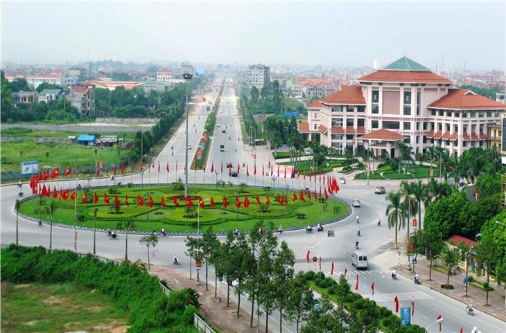
AsemconnectVietnam - plan of construction of Bac Ninh province in combination with the planning of construction of Hanoi capital, forming a pole of the growth triangle of Hanoi - Bac Ninh - Vinh Phuc, becoming a civilized urban area in the region. the capital and the Asia-Pacific region
a) Location and scope of planning: The whole administrative boundary of Bac Ninh province is limited as follows: Bac Giang province borders on the north; Hai Duong to the East; Hung Yen province borders Hung Yen province; Hanoi borders on the West.
b / Scale of planning: The natural area is about 822.71 km2; The population in 2017 is about 1,317,817 people.
c / The planning duration: The short-term up to 2022, the long-term up to 2035, the planning vision till 2050.
2. Planning objectives
- plan of construction of Bac Ninh province in combination with the planning of construction of Hanoi capital, forming a pole of the growth triangle of Hanoi - Bac Ninh - Vinh Phuc, becoming a civilized urban area in the region. the capital and the Asia-Pacific region.
- Bac Ninh city's urban center expansion plan, including Bac Ninh city, Tu Son town, Tien Du district, Que Vo district, Yen Phong district, plays the role of "head of ship and nuclear" Its socio-economic development will meet the standard of grade I urban centers, which will serve as a basis for building Bac Ninh province into a centrally-run city.
- To preserve and promote the values of cultural and historical heritages, step by step build modern Bac Ninh architecture, attach importance to the preservation and promotion of traditional architecture, bearing the Bac Ninh-Kinh cultural characteristics. North.
- To build Bac Ninh province with a solid economic base, synchronous and modern infrastructure and a good living environment in the direction of urban culture, ecology and smart cities to meet the basic needs. material and spiritual texts of the people; harmonious development between urban, rural, people and nature; well-preserved environment, ecological balance and response to climate change.
- To set up a basis for managing and attracting resources for investment in the construction and development of regions according to the planning and law, ensuring quality and efficiency.
- To build and develop a provincial area in association with ensuring security and defense.
3. The nature of the planning
- Being one of the economic centers of the Capital Region, the northern key economic region; Located on the economic corridor of Lang Son - Hanoi - Hai Phong - Quang Ninh and Lao Cai - Hanoi - Hai Phong - Quang Ninh with focus on industrial and service development, focusing on knowledge economy (education - training, research and application of science and technology), trade, high technology industry.
- Being a hub for exchanges and regional centers for trade, cultural and historical tourism in the capital Hanoi.
- As a city in the capital of sustainable development towards knowledge economy and "smart urban", the direction is the central city.
- Having an important position in terms of security and defense.
4. Vision to 2050
- Bac Ninh province, together with Hanoi, Hai Phong and Quang Ninh, is a driving force for economic development in the Red River Delta, the northern key economic region and the whole country. Cultural exchanges and cultural and historical centers of the Capital Region; Bac Ninh city becomes a competitive development center of the country and Asia-Pacific region, high technology development center of Asia and the world.
- Become a smart city, centrally located, with features:
+ Modern, civilized, civilized, harmonious, sustainable.
+ Having a strong economic base, ensuring good social security and high quality of life.
+ Modern urban development, culture, ecology, knowledge, smart urbanization and rural modernization.
+ Safe response to climate change.
5. Regional development forecasts
- The average annual growth rate is 201 - 2035: about 11-13%;
- By 2022, the province's population will be about 1.56 million; urbanization rate is about 65 - 70%;
- By 2035, the population of the whole province will be about 1.8 million, the urbanization rate will be around 80%.
- By 2050, the population of Bac Ninh province will be about 2.0 million, with an urbanization rate of around 90%.
- The target of civil land in the new development area is about 90 m2 / person.
6. Orientation for spatial development
a) Developmental structure
- Urban development corridor, service along national highway No.1, linking Tu Son - Tien Du - Bac Ninh with the urban development axis of Hanoi - Bac Ninh - Bac Giang.
- The urban and industrial development corridor along national highway 18, linking from Yen Phong - Bac Ninh - Que Vo, to building urban industrial parks and developing service urban centers for industrial development.
- The high-tech eco-agricultural, industrial and ecological corridor along Highway 17, linking Que Vo - Gia Binh - Thuan Thanh.
- Service Urban Development Corridor along Highway 38 and Ring Road 04, Bac Ninh City, Thuan Thanh.
- A corridor for the development of spiritual and ecological tourism along the Duong River.
b) Territorial organization
- The North Duong area is an inner city of a centrally-run city with the function of a political, administrative, economic, cultural, educational, scientific and technological center. Center area is Bac Ninh city.
- South of Duong River is a suburban area of the city under the Central Government, including: Thuan Thanh District with the function of the Industry - Service - Agriculture; Gia Binh district with the function of agriculture - industry - service area and Luong Tai district with the function of agriculture - industry - service area. The regional center is Thuan Thanh urban area.
c) The urban system
- Orientations for development of the urban system up to 2035, including 07 urban centers:
Bac Ninh urban center of grade I with an area of about 491.07 km2; Population in 2035 about 1.340.000 people, planned in the area:
. Bac Ninh city area: Area of 82.64 km2; in 2022 the population will be around 295,000; in 2035 about 310,000 people; It is the center of general, administrative and political of the city in the future.
. Tu Son area: Area 61.09 km2; in 2022 the population will be about 230,000 people, in 2035 about 270,000 people; It is an economic, industrial and service center.
. Tien Du area: Area: 95.6 km2; By 2022, the population will be around 182,000; in 2035, about 210,000; It is a center of trade, culture, tourism and clean industry.
. Yen Phong area: Area of 96.93 km2; 2022 population of about 255,000 people; in 2035 about 320,000 people; It is a center for industry and service development.
. Area of Cinnamon Martial Arts: Area of 155,11 km2; by 2022 the population will be about 210,000 people, in 2035 about 230,000 people; is the center of industry, service.
Thuan Thanh urban center: grade-IV urban center; Area of 117.83 km2; in 2022 the population will be about 183,000 people, in 2035 about 200,000 people; The nature is urban services, industrial, agricultural high technology.
Gia Binh urban area - Gia Binh district: grade V city; area of 11.03 km2; 2022 population: about 15,600 people, in 2035 about 18,500 people; is the district town of Gia Binh district.
Thuy Town - Luong Tai District: Grade V; area: 11.46 km2; in 2022 the population will be about 19,000 people, in 2035 about 22,200 people; is the district town of Luong Tai district.
Nhan Thang Urban - Gia Binh District: Urban V; area of 8.19 km2; The population in 2022 is about 9,000 people, in 2035 about 10,000 people; is urban service.
Trung Kennh urban area - Luong Tai district: grade-V urban centers; Area of Trung Ken commune is 7.04 km2; The population will be about 5,000 in 2022 and about 10,000 in 2035; is urban service.
Cao Duc City - Gia Binh District: Grade V City; area of Cao Duc commune is 11,469 km2; The population is about 7,000 in 2035; is urban service.
- Planning for the development of new urban key areas, development of the "tourist, cultural and ecological" belt of the Duong river:
Provincial-level functional zones: The Science and Technology Research and Training Sub-Department I (Village I) in Bac Ninh city with an area of around 200 hectares; The Science and Technology Research and Training Center II (University Village II) in Tien Du district with an area of about 500 ha and adding urban functions to the training area; Phuc Tich tourist urban area of about 2,200 ha in Tien Du district; Bac Ninh Provincial Sports Complex with an area of 135 ha in Tien Du and Que Vo districts; The urban, ecological, cultural, convalescence, entertainment in the area of Tien Du district, town of about 1,400 ha; Cultural and ecological tourism area of mountainous area of about 200 ha in Bac Ninh city; Thuan Thanh international golf course with an area of 100 ha in Thuan Thanh district, Yen Phong international golf course with an area of 100 ha in Yen Phong district; Urban complex, cultural tourism, entertainment area of about 2,000 ha in Thuan Thanh district.
d) Rural residential area system
- Modernization of rural areas under the program of building new rural areas, improving the quality of life of rural people.
- Improving and embellishing associated with the preservation of cultural values, traditional history, natural landscape; public utilities, technical infrastructure and social infrastructure. To specify the list of works, objects and spaces to be preserved so as to adopt appropriate measures.
- To strictly control the density of construction, height of works, architecture of works and protection of the landscape and environment in rural areas; to control to the utmost the spontaneous urbanization; Unsuitable architectural form that breaks the landscape and environment of rural areas; preserving the village space in rural and urban areas.
e) Special control areas
- Flood drainage corridors such as Duong river, Cau river bridge and Thai Binh river shall be implemented in accordance with the planning, specifically determining the flood drainage boundary, the location of dykes and specifying construction activities according to each area.
- Important historical and cultural sites: To draw up specific lists, determine values and prescribe conservation boundaries as the basis for the construction and protection of monuments under the Conservation Law. heritage.
- Landscape areas of Duong River, Phat Tich, Nui Dam, Thien Thai Mountain: Conservation planning, development associated with tourism projects, exploitation of natural landscape space.
- Security and defense areas: To restrict the change of the use purposes of the national defense and security land funds; Construction investment must be agreed upon by the competent agencies according to regulations.
- Control and prohibit all construction activities in relation to: flood protection corridors; the corridor protecting historic and cultural relics; to protect the safety of technical infrastructure lines; a reserve corridor for the development of infrastructure lines; landscape of ecology.
e) The system of production establishments
- Concentrated industrial parks, hi-tech parks and industrial clusters:
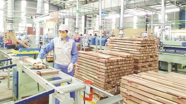
Concentrated industrial zone: According to the plan for development of industrial parks in Bac Ninh province, which was approved by the Prime Minister with the total area of 6,397.7 hectares.
High-tech park planning area of about 250 hectares.
Industrial clusters: According to the planning on industrial clusters approved by the provincial People's Committee (with a total area of around 900 ha by 2035), it will be gradually adjusted to urban areas.
- Trade, service and tourism
To prioritize the development of high-quality services, attracting large population such as education and training; research and application of science and technology; health and relaxation; cultural and commercial tourism.
To develop the exhibition center, shopping center and 02 logistic centers in Que Vo area about 100 ha and the area of Yen Phong district - Bac Ninh city about 100 ha. To develop trade centers, shopping centers, wholesale centers and large supermarkets in the center of urban areas. To develop the wholesale market system in association with trade villages and concentrated agricultural production areas in order to support local agricultural production activities. Upgrading existing market system.
Planning to turn Bac Ninh into an attractive eco-tourism and cultural center of the Red River Delta and the whole country with international significance in Bac Ninh city, Tu Son town, Thuan districts Thanh, Gia Binh, Tien Du, towards the development of connecting cultural and tourist clues. To form road and waterway routes on rivers, especially the Duong River.
- Agriculture:
Planning and arrangement of agricultural land use, including concentrated agricultural production areas in the South of Duong River, especially Gia Binh and Luong Tai Districts; High-tech suburban and suburban agricultural areas associated with the urbanization process in central urban centers of Bac Ninh and Thuan Thanh districts, on the basis of preserving the two-crop land fund under the Prime Target. cover.
To step up the reorganization of production on the basis of models of agricultural cooperatives (production - processing - consumption).
g) Social infrastructure system
- Offices, offices
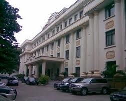
The provincial administrative-political center in Bac Ninh city. The existing district administrative center will be upgraded to meet the needs of urban development.
Development of public administrative centers and the construction of inter-institutional buildings.
- House
+ Orientations to 2022: Urban dwelling houses will reach about 30 m2 / person, rural houses will be 25 m2 / person; By 2035: Residential area of urban area 35 m2 / person, house in rural area 30 m2 / person.
+ To develop urban houses in association with investment projects on synchronous urban areas in terms of technical infrastructure and social infrastructure.
+ To strictly control the development of houses in rural population quarters in the architecture of works, the density of construction, the height of the works. Minimize the impact on traditional village spaces and historical cultural relics.
+ To attract the development of social housing projects according to the urban development planning according to urban criteria of class I.
- The education and training system
+ Master plan of urban center in Bac Ninh city and Tien Du district in order to attract training institutions from the center of Hanoi to move out and the new building, creating the area To create a motive force for the development of science and technology of Bac Ninh province and high quality human resources.
+ In Bac Ninh city and Tu Son town, to develop vocational training establishments for laborers in Bac Ninh province and surrounding areas.
+ To develop the system of general education establishments up to the standards, norms and high quality, combine the construction and renovation of existing establishments to meet the population growth and population distribution needs. to ensure access distance, to connect with the sports field, to build a full boarding facilities, experimental.
- Health care, community health care
+ To develop large provincial-level hospitals in Bac Ninh city and Tu Son provincial capital; Great health center, convalescence in Tien Du district.
+ To build a system of provincial medical centers according to the planning on development of the health sector of Bac Ninh province.
+ To attract the development of specialized and high-quality general hospitals and international standards. To renovate and upgrade existing general hospitals.
+ Promote the development of non-public health.
- Works, cultural institutions, sports
+ To plan regional cultural, sport and physical training centers in Bac Ninh city and the regional capital-sport and physical training center in Nam Son urban center.
+ To develop the system of green trees, parks, water surface, large-scale entertainment areas and sports complexes in key areas: Nui Dam, Phat Tich tourist resort, green corridor Drains, ecological urban areas, mountain rivers, green corridors and specialized agricultural areas make up the natural frame, ecological balance, reaching the maximum green trees.
h) Development orientations follow smart urban model
- To develop Bac Ninh in the direction of knowledge economy, hi-tech production, building a smart urban model in the province according to the planning on development and development of intelligent infrastructure and scientific application. technology in the management of urban and rural development. Nam Son area has been built to become the center of scientific motivation, promote socio-economic development of the province, become the center of regional and national innovation.
- To develop the transport system and intelligent infrastructure, green infrastructure, apply science and technology in construction investment, management and operation of technical infrastructure system, creating reserve corridors for intelligent infrastructure. Future.
- Applying scientific and technological achievements to control environmental issues, control of natural disasters and response to climate change. Particular attention is paid to the production environment of craft villages, construction environment and public safety.
- To develop smart utilities for urban inhabitants, to encourage urban areas and urban projects to be built according to smart urban models, to determine specific development targets for each area, In each stage, to set the direction of intelligent urban development.
i) Orientations for developing green corridors, blue wedges, green belts
To form green corridors in association with the rivers Duong, Cau, Thai Binh and Ngu Huyen Khe; Green belts surround urban areas to limit the spontaneous spillover of urban areas and blue cliffs. Green spaces are associated with the conservation of heritage sites, the provision of ecological services to urban areas, and the creation of a landscaped environment for urban activity. Specific design solutions for each area are carried out in accordance with the specific planning scheme attached to the actual situation of each area.
7. Orientations for land use planning
- By 2022: Land for non-agricultural use is about 43,846 ha (accounting for 53.3% of the natural area), agricultural land is about 38,425 ha (accounting for 46.7% of the natural area). By 2035: The land fund for non-agricultural land shall be about 50,471 ha (accounting for 61.3% of the natural area), the agricultural land area shall be around 31,800 ha (accounting for 38.7% of the natural area).
- To protect the natural landscape land bank along the rivers, lakes and landscapes, cultural and historical relics; To strictly control the use of land within the technical safety corridors, the land of natural protection frames and the kinds of land in areas banned from construction according to the provisions of law.
- To arrange a land fund with favorable conditions for the construction of urban and rural areas; industrial zones and clusters; tourist zones and clusters; social infrastructure and technical infrastructure and other non-agricultural land categories.
8. Orientation of technical infrastructure system
a) Orientations for traffic planning
To make full use of the existing transport infrastructure, maximize the geographical advantages of the province, focus on renovating, upgrading and building a modern and synchronous transportation network; To diversify forms of transport, to connect the modes of transportation (waterway, road, railway and air); Developing a variety of public transport systems suitable for urban areas.
- Road:
+ Formation of main axes:
. Linkage Axis: Ring Road 4 Hanoi; expressway of Hanoi - Thai Nguyen; expressway of Hanoi - Lang Son; Noi Bai - Bac Ninh - Ha Long Expressway; Hanoi - Lang Son railway, Yen Vien - Ha Long railway.
. Urban linkage axis: Highway 17; Highway 18; Highway 38; provincial road 295B; provincial road 295C.
. Link axis: Provincial road 276; provincial road 279; provincial road 281; provincial road 282B; provincial road 285; provincial road 285B; provincial road 287; Provincial road 277 forms a belt connecting inner city and suburban areas,
+ Form the main "gateway":
. Bac Ninh - Hanoi: Ha Noi - Lang Son expressway; Highway 17;
. Bac Ninh - Noi Bai: Noi Bai - Bac Ninh Expressway;
. Bac Ninh - Thai Nguyen: Hanoi - Thai Nguyen expressway;
. Bac Ninh - Bac Giang: Ha Noi - Lang Son expressway;
. Bac Ninh - Ha Long: Noi Bai - Ha Long expressway;
. Bac Ninh - Hung Yen: Ring 4; 283 - Van Lam;
. Bac Ninh - Hai Duong: Highway 38; Golden channel - Highway 37;
+ Static traffic: To arrange 03 regional bus stations serving in and outside the province, near the main roads of Ring Road 4 and 38; Noi Bai - Bac Ninh - Ha Long expressway and provincial road 295C; Highway 18 and Noi Bai - Bac Ninh - Ha Long expressway.
- Rail
+ National railway: 3 routes
. Hanoi - Lang Son route. Upgrading and upgrading the current status to ensure traffic safety. To supplement the Hanoi - Bac Ninh route according to the planning adjustment for construction of Hanoi capital, the route along Ring Road 4 and the Ha Noi - Ha Long expressway.
. Ha Noi - Ha Long route: The route goes along the Ha Noi - Ha Long expressway.
+ Continue construction Yen Vien - Cai Lan railway based on the planning has been implemented.
+ Regional passenger railways: 3 routes.
. The Hanoi - Bac Ninh - Bac Giang route, along the highway Hanoi - Lang Son.
. Ha Noi - Vinh Yen route, along the expressway Hanoi - Lang Son, then turn toward the highway Ha Noi - Thai Nguyen to Vinh Yen.
. Hanoi - Hai Duong route, along the expressway Hanoi - Lang Son and Ha Noi - Ha Long expressway to Hai Duong. The route goes along Highway 18 for easy access to urban residential areas.
- Waterways: To build the port system, goods transportation, passenger and tourist services; To intensify the improvement of the navigation channel, attaching importance to the exploitation of Cau, Duong and Thai Binh rivers. To support the transportation of goods to deep-water seaports and seaports in Quang Ninh and Hai Phong areas, focusing on the Duong and Duong Binh rivers. Que Vo ICD Port.
- By air: Using Noi Bai International Airport, about 31 km from Bac Ninh urban center along Highway 18.
- Public transport
+ To renovate existing bus routes including: Bac Ninh - Ho - Gia Binh - Thua, Bac Ninh - Pho Moi and Bac Ninh - Lim - Tu Son, Bac Ninh - Chay. To develop fast buses for main routes: Bac Ninh - Ho, Yen Phong - Tu Son - Tien Du - Bac Ninh; Associated with the urban rail station under the TOD model.
+ Planning and preparation of investment in the construction of urban railway system along the axis of linking the area: Tu Son - Tien Du - Bac Ninh - Que Vo; Bac Ninh - Tien Du - Lake.
b) Flood drainage and zoning for drainage:
Flood drainage in Bac Ninh is implemented in accordance with Decision No 257 / QĐ-TTg dated February 18, 2016 of the Prime Minister approving the master plan for flood prevention and dike planning in the Red River and Thai Binh rivers; Regularly inspect, repair and ensure the safety of dykes with the anti-flood frequency of 2%.
Geographical area: The whole area is divided into two subdivisions: North Duong and Nam Duong.
- North Duong area: The total area is about 46,089 ha. Drainage through the irrigation canal system (Nam Con, Dang Xa canal, Tao Khe channel, Kim Doi canal, Hien Luong canal, Trinh Xa canal ...) and pumped into Ngu Huyen Khe, Cau river, Duong river.
To open, expand, dredge main shafts of the zoning. To renovate, upgrade and build new pump stations to meet the water drainage demand of the whole province.
c) High-level construction orientation
The ground leveling plan is in close coordination with the rain water drainage planning, ensuring that it is not affected by floods, adverse impacts of nature and climate change. The height of each urban base is selected according to the hydrographic regime of the river, which directly affects the urban area; Comply with current regulations, important level, not in conflict with approved plans and in harmony with adjacent built areas. The average elevation for new areas in Bac Ninh is as follows: Yen Phong urban area Hxd = 5.5 m. Kinh Bac urban area is 4.5m. Que Vo Urban Hxd = 4.5m. Tu Son Hxd urban area = 6.0m. Tien Du urban area = 5.0m. Thuan Thanh town Hxd = 4,5m. The urban area of Gia Binh district and Luong Tai district Hxd = 4,0m. Rural residential areas with a new height of 1 ÷ 1.5m above the ground level. The old construction site, the height base control step by step improvement when conditions.
d / Orientations for planning of surface water drainage systems
Maximize the drainage capacity of the surface of the drainage system, increase the area of permeability of rain water, arrange the system of works to regulate rain water, combine with the solution of irrigation pump reasonable. Restrictions on conversion of existing irrigation water areas to other purposes.
Urban area:
- To renovate and build a network of sluice gates, canals, rivers and pumping stations, works for infiltration, storage and storage of rain water. To renovate, conserve and minimize pollution of existing lakes, promote the integrated function of lakes and lakes. The system of reservoirs is distributed in all basins, striving to ensure that the area of the reservoir is 5-8% of the urban construction area.
- To renovate the existing water drainage system in the direction of separating wastewater from rain water drainage systems. To complete the construction of separate water drainage systems for new development areas or drainage systems.
Suburban and out-of-town areas:
- Selection of drainage system in accordance with irrigation drainage system and local conditions.
- To renovate, consolidate and prevent the erosion of canals, ditches and rivers so as to ensure water drainage sections, especially areas crossing population quarters,
e) Planning orientations for power supply
Total demand for the province by 2035 is about 3,700 MVA.
Power source: To build 500kV transformer station of Bac Ninh from 500 kV turning branch into 500 kV Hiep Hoa - Pho Noi line with the capacity of 3x900 MVA; 220 KV Bac Ninh 4, Bac Ninh 5, Bac Ninh 6, Bac Ninh 7; 110 KV stations. To raise the capacity of the existing 220 KV and 110 KV stations in the province in each period to suit the development speed of additional charge.
Power grid: To build additional 220 KV and 110 KV power lines connecting Bac Ninh 500 kV substation with 220 KV and 110 KV stations in the province.
Step by step, underground current high voltage lines within the central city. Newly constructed and rehabilitated electricity grids in the central urban area must be underground.
To renovate and complete the urban lighting system in line with the nature of the project's functions and standards. The rate of 100% of urban roads and over 85% of laneways is illuminated with high efficiency. Develop lighting control model for urban areas.
e) Orientation of communication planning
Upgrade switching technology, building transmission network across the province. To synchronously deploy underground cable systems under the system of underground works in urban areas. To invest in upgrading information infrastructure in service of socio-economic development and serving as a basis for building smart urban centers in the central urban area.
Develop and improve the quality of the postal network, combining the provision of public services with commercial services to meet the needs of social development.
To intensify the uniform application of information technology systems to people in all spheres of socio-economic life.
To strongly develop information technology infrastructure in the direction of modernity, high speed, broadband, following the trend of the world, connected from the central to local and other provinces.
To perfect the technical infrastructure according to advanced, modern and synchronous technologies, ensuring information safety and network security for the whole province, efficiently applying cloud computing technology, fully satisfying bridge of the people.
To step up investment in the development of concentrated information technology parks, software parks and centers providing information technology services to the markets inside and outside the province.
g) Orientations for water supply planning
Water resources: To exploit the main water sources of Duong river, Thai Binh river and part of Cau river; groundwater exploitation of small scale.
Headworks:
- The capacity of some major water plants (North) in the North of the Red River to 2035; NMN in Que Vo district (granted to Bac Ninh city and Que Vo district) with the capacity of 200,000 m3 / day; NMN of Tien Du district with a capacity of 60,000 m3 day and night; NMN of Yen Phong district capacity of 40,000 m3 day and night. Duong River WTP, Gia Lam, Hanoi is the additional water source for Bac Ninh 60,000 m3 day and night.
- Capacity of some main water plants in the South of Duong River: Thuan Thanh district with a capacity of 40,000 m3 day and night; NMN of Gia Binh district with the capacity of 20,000 m3 day and night; NMN of Luong Tai district with the capacity of 40,000 m3 day and night.
h) Planning directions for wastewater collection and treatment
Total volume of wastewater up to 2035 is about 400,000 m3 / day. The rate of urban wastewater collection is over 90%.
To renovate and upgrade the system of culverts in inner cities and old urban centers; New urban areas must build their own waste water drainage systems and concentrate wastewater treatment. The planning of wastewater treatment plants in urban areas must ensure environmental hygiene and modern technological chains. Rural areas shall build common water drainage systems, prioritizing the treatment of biological wastewater in natural conditions. Health facilities, industrial zones and clusters must collect waste water separately and treat it up to environmental standards.
i) Planning orientations for solid waste collection and treatment
Total volume of solid waste up to 2035 is about 3,500 tons / day and night.
The rate of urban waste collection is 100%, the rural area is over 95%. Solid waste is gradually sorted at the source. To build and expand 06 concentrated solid waste-treatment facilities with a total area of around 100 hectares, including treatment areas north of the Duong river in Que Vo and Yen Phong districts and treatment areas south of Duong river at Luong Tai district, Gia Binh district and Thuan Thanh district.
The provincial solid waste treatment complex in Phu Lang applies integrated technology including burning, recycling of inorganic substances, processing of organic fertilizers and hygienic burial. To prioritize the application of energy recovery technologies at provincial and district-level treatment establishments.
Long-term to 2050, there should be solutions to link with neighboring provinces such as Bac Giang, Hung Yen and Hai Duong to arrange new regional treatment facilities in line with the planning orientation of the proposed capital region.
j / Orientations for cemetery management planning
To step by step stop the burial in cemeteries located in Bac Ninh city, districts of Yen Phong, Tien Du and Tu Son. Demand is buried in the cemeteries of southern Duong and Que Vo districts.
The closure of cemeteries has filled up urban areas and planted green trees to ensure the landscape environment in the direction of the garden.
To build and expand 10 cemeteries attached to each urban center, district or town with a total area of over 200 hectares. Construction of a crematorium in Thuan Thanh district.
Construction of new funeral homes for the central city and Thuan Thanh urban area.
9. Strategic Environmental Assessment
a) Environmental issues of concern;
- Minimize the social impact of conversion of land use.
- Preventing, minimizing impacts caused by waste arising.
- Protect ecosystems and biodiversity in the area.
- Improve adaptability to climate change.
b) Measures to minimize impacts and protect the environment:
- Apply technology, technology.
- Develop a climate change adaptation plan.
- Develop a plan to prevent environmental accidents.
- Defining areas for ecosystem protection, biodiversity conservation.
- Manage and monitor the quality of the environment.
10. Priority investment programs and projects
- Elaborating the scheme on the establishment of the centrally-run city; Smart city plan; The project of preserving and promoting the heritage system. Adjust the Urban Development Program of Bac Ninh Province to 2035.
- Adjust the general planning of Bac Ninh city to 2035 and vision to 2050.
- To build a system of infrastructure works connected with Hanoi capital.
- To develop urban, tourist, trade and service centers of the province.
- To develop concentrated industrial parks and hi-tech parks.
- Scheme on enhancing management capacity of urban authorities.
- Proposing mechanisms and policies to promote investment attraction.
Long Giang
Program on conservation and development of Vietnamese craft villages in a period of 2021 - 2030
Implementation plan of marine aquaculture development project in Ninh Binh province to 2030 with a vision to 2045
Plan on implementing national environmental protection strategy to 2030 with a vision to 2050 in Kien Giang province
Plan on implementing Decision No. 327/QD-TTG dated March 10, 2022 of the Prime Minister approving the project on developing sustainable and effective wood processing industry in the period of 2021-2030 in Gia Lai province
Action plan on implementing strategy of sustainable agricultural and rural development in a period of 2022-2030 with a vision to 2050 in Hanoi city
Plan on implementing Decision No.923/QD-TTG dated August 2, 2022 of the Prime Minister approving science and technology program for new rural construction in a period of 2021-2025 in Vinh Long province
Plan on implementing strategy of sustainable agricultural and rural development in Bac Kan province in a period of 2021 - 2030 with a vision to 2050
Action plan on implementing livestock development strategy in a period of 2022-2030 with a vision to 2045 in Hanoi city
Implementation plan of Vietnam's forestry development strategy for a period of 2021-2030 with a vision to 2050 in Gia Lai province
National master plan in a period of 2021-2030, vision to 2050
Program on strengthening environmental protection, food safety and rural clean water supply in building new countryside in a period of 2021-2025
Digital transformation program on building new countryside, towards smart new countryside in a period of 2021 - 2025
Rural tourism development program on new rural construction in a period of 2021 - 2025
Project on development of trade, e-commerce systems and border trade in Binh Phuoc province in a period of 2021-2025, orientation to 2030
Plan on implementing Decision No. 327/QD-TTG dated March ...
Concretize viewpoints, objectives, tasks and solutions of the plan in accordance with practical conditions of the locality, associating ...Plan on implementing national environmental protection ...
Implementation plan of marine aquaculture development ...
Program on conservation and development of Vietnamese ...
Plan on improving quality of human resources to 2025 and ...

Efforts taken to turn culinary culture into national ...
The Vietnam Cuisine Culture Association (VCCA) is taking steps to implement a project to build and develop Vietnamese culinary culture ...Vietnamese cuisine making a name for itself with ...
Vietnam advance to next round of AFC U20 Women’s Asian Cup
Cultural tourism and traditional values promoted through ...
