


Construction plan of Hon La economic zone
Monday, April 13,2020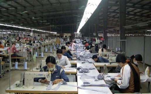
AsemconnectVietnam - Being an economic center of Quang Binh province with modern and synchronous urban infrastructure
CONSTRUCTION PLAN OF HON LA ECONOMIC ZONE – QUANG BINH PROVINCE TO 2030
1. Boundary, area
Planned zone covers an area of 10,000 ha, including area of island and sea, geographical boundaries are defined as follows:
- Bordering Ha Tinh province in the north;
- Bordering Quang Tho commune, Quang Trach district in the south;
- Bordering communes of Quang Kim, Quang Chau, Quang Tien, Quang Luu, Quang Phuong and Quang Long in Quang Trach district;
- Bordering East sea in the east.
2. Characteristics
- Being a multi-branch, multi-disciplinary economic zone, including: industry - seaport - trade - services - travel - urban and agriculture, forestry, fisheries;
- Being an economic center of Quang Binh province with modern and synchronous urban infrastructure; having a leading role to attract investment and being development driving force for other areas.
3. Population scale
- To 2020: around 58,000 people;
- To 2030: around 76,000 people.
4. Land using plan
4.1. Land area for non-tariff zone: 36.0 ha.
4.2. Land area for tariff zone: 9,964 ha,
- Land area for construction of functional zones: port, industry, tourism, urban area, infrastructures ...: 3,189.4 ha. Out of which:
+ Land area for ports: 133 ha;
+ Land area for concentrated industrial parks: 1,353.5 ha;
+ Land area for tourism zones: 3,96.96 ha (ecotourism zone of Vung Chua – Yen island, ecotourism sites and cultural, historic relics: Vinh Son temple, Lieu Hanh princess temple...);
+ Land area for urban and functional zones: 1,257.8 ha.
- Land area for rural residential zones and agro-ecological zones: 5,761.9 ha. Out of which, rural residential zones: 247.6 ha.
- Area of island and sea: 1,012.7 ha.
5. Development orientation of spatial and functional areas
5.1. Spatial development structure is under 03 main traffic routes include highway 1A, west road coastal road; concentrated development areas stick closely on port zone in north economic zone, out of which, Hon La deep-sea port is nucleus of economic zone. Industrial parks are located in convenient transport location. Urban and tourism zones are located near coastal area. High tech agro ecological and tourism development areas are located in south Roon river. Land area for military are retained to serve national security requirements. High mountain and hill areas are for development of afforestation and forest ecology.
5.2. Functional areas
- Non-tariff zone: locating closely to key road to synthesis port which is convenient for external economic activities, covering an area of approximately 36 ha.
- Tariff zone:
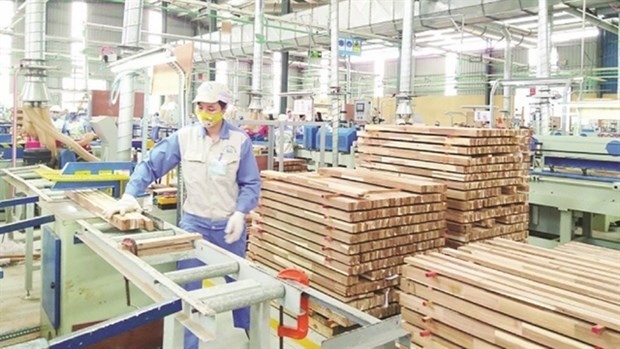
+ Industry: Total land area for industrial construction of Hon La economic zone is about 1,486.5 hectares, including Hon La port with an area of 133 ha in commune of Quang Dong; sea port industrial park in commune of Quang Dong with a scale of 613.5 ha; Industrial park No. 2 in Quang Phu commune with a scale of about 485 ha; Industrial cluster of salt production and seafood processing with a scale of about 90 ha; industrial park with a scale of about 118 ha in west gate of the economic zone and industrial cluster in south gate of economic zone with a scale of 47 ha;
+ Urban residential area: total land area for urban construction of Hon La economic zone is around 754 hectares, including 6 areas (including new residential area and resettlement area): resettlement area No.1 in north highway 1A and resettlement area No.2 in north mountain of Tho Son with a scale of about 51 ha; new urban area and resettlement area No.3 in south non-tariff areas with a scale of 108 ha; new urban areas and resettlement area No.4 in north Roon river with a scale of 225 ha. New urban areas and resettlement area No.5 in north Roon river and salt field of Quang Phu with a scale of about 110 ha. New urban areas and resettlement area No.6 in south Roon river and east highway 1A in communes of Canh Duong and Quang Hung with a scale of about 260 ha;
+ Rural residential area: old village areas, upgrading and improving transport infrastructure, raising people's living. House model are a garden house, villa, mainly locating in Quang Tung, Quang Hung, Quang Xuan communes;
+ Ecology tree and tourism zone: locating along coast, along river, hill and water surface to create landscapes and improve microclimate for economic zone, including: tourism zone of Lieu Hanh princess relic with an area of approximately 38.4 hectares; tourism zone of Vung Chua - Yen island; Dong Hung sea ecotourism zone with a scale of around 30 hectares; sea eco-tourism zone in north resettlement area with a scale of about 22.7 hectares and along coast in the south with a scale of about 269 ha;
+ Agricultural zone: having an area of 1,169 hectares, planting food crops towards intensive-cultivation, enhancing food crops, fresh vegetables, premium vegetable for new urban zone, tourism zone ... Developing garden and farming economic to grow fruit trees and ornamental plants;
+ Forest area: maintaining an area 2848 ha of forest land on environmental protection, timber exploitation and development of mountainous ecotourism. Boosting to plant coastal protection trees against wind and sand, planting concentrated forest on existing mountains to form green belt of protecting the economic zone;
+ Land area for construction of key infrastructure projects, including: Hon La general and specialized port with a size of about 140 ha, stations of electricity, waste water treatment, solid waste treatment, water supply with an area of approximately 20 hectares;
+ Military zone: focusing on high points of Quang Dong commune with a scale of about 430 ha.
6. Plan orientation of infrastructure system
6.1. Transport: external and internal transport system must conform to transport plans which were approved by competent authority.
- External transport system:
+ System of seaports, river ports: including general ports, specialized ports, fishing ports which are studied, developed in accordance with port plans of Ministry of Transport and the province;
+ National roads and railway;
+ To arrange intersections connecting to north-south highway;
+ To construct Tien Chau – Van Hoa road connecting with key road of economic zone.
- Internal transport system:
+ System of railways, road in ports and industrial parks, ensuring a good connection and suitability for development;
+ Transport network in new urban area of Hon La;
+ To construct key east – west road, south - north road and coastal road which are in consistent with economic zone.
6.2. Technical preparation
- Foundation: controlled foundation altitude in new construction area is higher than + 2.75m. Foundation altitude of existing residential areas associates with foundation altitude of existing works, ranging from + 2.25m - ÷ + 3.0 m, depending on each location. Foundation altitude of riverside areas are equivalent to foundation altitude of road and existing residential area, ensuring flood drainage. Areas of field must have foundation altitude higher than level + 2,75m, depending on each location.
- Drainage direction:
+ Key drainage direction: Bau Giay canal, Can canal, Xuan Hung canal and many other small canals;
+ Narrow basin: in each small basins, rain water is collected in sewers in streets and then connecting to key sewer system and key drainage direction;
+ Drainage network: building mixture sewers. Constructing new sewer system in old residential area and new residential area.
6.3. Water supply
- Water supply source:
+ 2020: exploiting water source of Thai river lake with a capacity of 8,000 m3/day; exploiting groundwater resources in north industrial clusters with a capacity of 4,000 m3/day; exploiting water source of Vuc Tron lake with a capacity of 14,000 m3/day;
+ 2030: raising capacity of water exploitation of Vuc Tron lake to 28,000 m3/day.
- Water supply pipe network: using plastic pipe or cast iron pipe. Water for industrial activities: raw water supply pipe from high-pressure pump station to industrial parks have diameter D = 500mm. Water for people’s living: main supply pipe along key roads have diameter D = 300-400 mm.
- Criteria of water using: 150 liters/person/day and night for urban zone, non-tariff areas, 100 liters/day and night for suburban areas, 22m3/ha day and night for industrial parks.
6.4. Electricity supply
- Electricity source: electricity source supplying for Hon La economic zone takes from Ba Don stations (raising capacity of 110 KV Ba Don station to 110/35/22 KV- 1x25MVA + 110/22 KV- 1x40MVA) and 110/22 kV - 63MVA station in Hon La sea port industrial park.
- Grid:
+ 500 KV grid: connecting 500 kV transmission line from Quang Trach thermal power center to national line of 500 KV;
+ 35/22 KV grid: removing existing 35 KV line and building new line 22 KV under electricity supply plan for entire region;
+ 0.4 kV low voltage grid: It is expected that by 2020, 100% of households use national low voltage grid. Arranging grid stations and 0.4 kV power line to supply electricity in each area, ensuring radius of using low voltage grid <400m. Section of key line of 0.4 kV> 120 mm2, section of branch line of 0.4kV> 70 mm2. Using twisted cable of three-phase four-wire or PVC coated wire in accordance with standard.
- Standard on electricity supply:
+ Rural living electricity: 450 kWh/person/year;
+ Urban living electricity: 1,000 kWh/person/year;
+ Electricity for production: 150-400 KW/ha of industrial land.
6.5. Waste water drainage and environmental sanitation
- Waste water drainage:
+ Living wastewater: Urban areas uses separate waste water drainage system, wastewater will be collected to concentrated wastewater treatment station to treat under current standards before being discharged into receiving sources. Constructing wastewater treatment station with a capacity of 10,300 m3/day and night in south;
+ Industrial wastewater: In each concentrated industrial park in Hon La will build a wastewater treatment station for the industrial park. Wastewater of industrial parks, handicraft industrial clusters must be treated under current standard before being discharged into environment.
- Sanitation:
+ Solid waste is collected and transported to concentrated solid waste treatment zone in Quang Tien commune;
+ Cemetery: People’s cemetery of north Roon river area will be located in commune Quang Dong, in west national road 1A. For communes in south Roon river, renovating and expanding existing cemetery in remote residential area, ensuring environmental protection.
7. First phase of construction plan to 2020
7.1. Land using plan
- Duty free land area: about 36 ha.
- Land area for construction of functional areas: port, industry, tourism, urban infrastructures ...: 1,580.5 ha.
7.2. Projects given priority to investment
- Completing system of Hon La sea port phase II;
- Resettlement residential area in north Roon river area;
- Road network in north Roon river area;
- Road from Tien Chau – Van Hoa to Hon La port;
- Quang Trach thermal power plant;
- Infrastructure system in industrial area after Hon La sea port;
- Housing for workers;
- Business and service center;
- Conservation, restoration of Lieu Hanh princess temple;
8. Environmental impact assessment
8.1. Plan solution
- To set up plan on protection and development of coastal sensitive ecological system, building plan on development of eco-tourism zone of Vung Chua – Yen island.
- To set up detailed plan of infrastructure system (transport, water supply, wastewater treatment and drainage, collection and treatment of solid waste, cemetery) to ensure a minimum risk level of unusual floods, droughts.
8.2. Technical, technology solutions
- Factories operating in industrial parks must have wastewater treatment system before discharge into general sewer system. All of treated industrial wastewater in industrial wastewater treatment station must achieves current regulations. Selecting industrial wastewater treatment technology which are suitable with mode of industry, ensuring to reach Vietnam’s standards.
- To select varieties of trees to develop system of green tree to reduce effectively noise, dust in each area of high pollution risk.
8.3. Management solution
- To require environmental impact assessment of detailed plans on industrial parks, resettlement areas, construction and renovation projects under requirements of environmental protection law.
- To set up mechanisms and policies to encourage development of clean industry, applying environmentally friendly production technology in industrial parks.
- To raise public awareness of the people, regional development managers about protection of natural resources and environment.
- To build force of preventing risk of oil spills which may occur in sea port area.
9. People's Committee of Quang Binh province should implements the following tasks:
- To publicize approved construction plan on Hon La economic zone to 2030.
- To develop and promulgate regulations on management of plan, urban architecture for Hon La economic zone Hon La.
- To establish, adjust detailed plan, urban design to concretize construction plan on Hon La economic zone to 2030.
L.Giang
Source: moj.gov.vn
Source: moj.gov.vn
Program on conservation and development of Vietnamese craft villages in a period of 2021 - 2030
Implementation plan of marine aquaculture development project in Ninh Binh province to 2030 with a vision to 2045
Plan on implementing national environmental protection strategy to 2030 with a vision to 2050 in Kien Giang province
Plan on implementing Decision No. 327/QD-TTG dated March 10, 2022 of the Prime Minister approving the project on developing sustainable and effective wood processing industry in the period of 2021-2030 in Gia Lai province
Action plan on implementing strategy of sustainable agricultural and rural development in a period of 2022-2030 with a vision to 2050 in Hanoi city
Plan on implementing Decision No.923/QD-TTG dated August 2, 2022 of the Prime Minister approving science and technology program for new rural construction in a period of 2021-2025 in Vinh Long province
Plan on implementing strategy of sustainable agricultural and rural development in Bac Kan province in a period of 2021 - 2030 with a vision to 2050
Action plan on implementing livestock development strategy in a period of 2022-2030 with a vision to 2045 in Hanoi city
Implementation plan of Vietnam's forestry development strategy for a period of 2021-2030 with a vision to 2050 in Gia Lai province
National master plan in a period of 2021-2030, vision to 2050
Program on strengthening environmental protection, food safety and rural clean water supply in building new countryside in a period of 2021-2025
Digital transformation program on building new countryside, towards smart new countryside in a period of 2021 - 2025
Rural tourism development program on new rural construction in a period of 2021 - 2025
Project on development of trade, e-commerce systems and border trade in Binh Phuoc province in a period of 2021-2025, orientation to 2030
Plan on implementing Decision No. 327/QD-TTG dated March ...
Concretize viewpoints, objectives, tasks and solutions of the plan in accordance with practical conditions of the locality, associating ...Plan on implementing national environmental protection ...
Implementation plan of marine aquaculture development ...
Program on conservation and development of Vietnamese ...
Plan on improving quality of human resources to 2025 and ...
Efforts taken to turn culinary culture into national ...
The Vietnam Cuisine Culture Association (VCCA) is taking steps to implement a project to build and develop Vietnamese culinary culture ...Vietnamese cuisine making a name for itself with ...
Vietnam advance to next round of AFC U20 Women’s Asian Cup
Cultural tourism and traditional values promoted through ...
