


Adjusted master plan of Ho Chi Minh City to 2040, vision to 2060
Thursday, March 31,2022
AsemconnectVietnam - The city's adjusted master plan in line with development orientation of the whole Ho Chi Minh City region, towards developing the city into an international trade center of the region and the country; center of culture, creative knowledge, scientific research and technology transfer, regional high-tech industry; center of tourism, finance - trade and international logistics services.
1. Research scope, boundaries and scale:
- Scope of plan boundary: entire administrative boundary of Ho Chi Minh City with an area of 2,095 km2 and Can Gio sea area (specific area will be determined during planning process, ensuring uniformity) with boundary of coastal protection corridor and overall exploitation and sustainable use of coastal resources). Specific boundaries are as follows:
+ The North borders with Binh Duong province;
+ The West borders Tay Ninh province, Long An province and Tien Giang province;
+ To the east, it borders Dong Nai province and Ba Ria - Vung Tau province;
+ The South borders the East Sea.
- The scope of the study: covers the entire administrative boundary of Ho Chi Minh City and surrounding provinces in the Ho Chi Minh City region (the southern key economic region, including the provinces: Binh Duong, Binh Phuoc, Tay Ninh, Long An, Dong Nai, Ba Ria - Vung Tau, Tien Giang; with an area of about 30,404 km2.
2. Planning period: to 2040, vision to 2060.
3. Objectives and viewpoints of adjusted plan:
a) Objectives:
- The city's adjusted master plan in line with development orientation of the whole Ho Chi Minh City region, towards developing the city into an international trade center of the region and the country; center of culture, creative knowledge, scientific research and technology transfer, regional high-tech industry; center of tourism, finance - trade and international logistics services.
- The city's adjusted master plan to meet new requirements in the city's socio-economic development strategy; create feasible conditions for synchronous implementation of solutions to solve current urban development problems such as population, housing, infrastructure, traffic, environment, adaptation to climate change and ensure national security.
- Create a legal basis for management of development, investment and construction of areas in urban area and perfect technical framework system of urban area according to the plan.
b) Viewpoint:
- In line with the city's socio-economic development strategy, national development strategy, national sectoral plan and Ho Chi Minh City plan in a period of 2021 - 2030, vision to 2050.
- To promote the city's leading role in relationship with the Ho Chi Minh City region, the southern key economic region, both nationally and internationally. Promote regional linkages, develop marine economy in association with goal of forming a chain of marine urban areas in the region, combined with protection of Can Gio biosphere reserve. Effectively promote all resources to build synchronous and modern infrastructure systems; focusing on prioritizing investment in traffic and digital infrastructure projects according to strategies and economic development models of the city and the city region.
- Inheriting and continuing to implement basic orientations, contents of current general plan are still relevant. Effectively exploiting natural conditions and typical ecosystems of the city to develop a modern city with identity, creating attractiveness of the city, gradually improving quality of the city. Developing harmoniously between economy and culture - society, environmental protection, adaptation to climate change; towards synchronization between new construction and urban renovation and embellishment.
- Closely combine with assurance of national defense, security and social safety in city development.
4. Urban characteristics:
- Being a city of special type directly under the central government; an important center of economy, culture, education and training, science, technology and technology of the country, playing a pioneering role in leading innovation and creativity; has an important position in national urban development strategy; is one of the centers of tourism, finance - trade and logistics services of Southeast Asia and Asia - Pacific.
- To be an important traffic and digital infrastructure hub in the Southeast region, nationally and internationally; is the regional linkage center, the focal point connecting various types of multimodal transport in the southern region.
- Being one of the areas with an important strategic position in terms of national defense and security in the Southeast region, the whole country and the East Sea region.
5. Preliminary development forecast:
a) Population size: It is expected that by 2040, population of Ho Chi Minh City will be about 13-14 million people.
b) Scale of land for urban development: by 2040, the estimated land for urban construction is about 100,000 - 110,000 ha.
(The specific analysis, evaluation and forecast of population size and urban construction land in each period will be studied and proposed during the study of the planning project).
6. Key requirements for general planning adjustment:
a) Overall review of the content of the general planning approved in 2010, on the basis of:
- Analyze international and regional context and assess actual socio-economic and environmental development of Ho Chi Minh City and the city area.
- Reviewing projects and planning in the area in Ho Chi Minh City that have been prepared and approved; orientation of urban space development, land use plan, technical and social infrastructure with actual development trend of the city.
- Evaluate process of implementing master plan in 2010; evaluate effectiveness of planning tools, solutions for management and mobilization of resources, organizational models for implementation, mechanisms and policies, etc. Identify emerging factors, shortcomings, problems in management and implementation.
b) Forecasting development needs in new period in context of regional development, new development opportunities, ensuring conformity with development practice in harmony with requirements of business development strategy, regional and national socio-economic, marine economy, highly interactive creative urban development, smart city, sustainable urban development.
c) Adjusting orientation of spatial development, land use and technical infrastructure of the city in accordance with vision and flexibly adapt to socio-economic fluctuations and climate change; creating more room for development from value of land, ensuring reserve capacity for future and protecting ecological environment.
d) Research and update important guidelines and orientations of national and regional planning related to the city scope; coordinate the city's guidelines, programs, schemes and projects in a development framework with long-term vision and high implementation.
Formulate a specific plan for implementation of master plan with reasonable divergence, associated with resources for implementation; show scope of space - land; select priority problems to solve (regional linkages, population distribution, housing, quality of life, urban traffic, flood management, resource use...), improve real status and promote urban, economic - social development of the city.
e) Coordinate and agree on data, forecasts, development orientations and related contents with process of making Ho Chi Minh City master plan for a period of 2021 - 2030, with a vision to 2050 and sectoral master plans, other specialized plans are being formulated at the same time.
7. Specific requirements on planning research contents:
a) Analysis and assessment of urban development context and status:
- Analysis of location and inter-regional relationship: assess advantages and limitations of the city's geographical location; analyze international and regional context, development orientation and strategy of the country and region that have an impact on the city's development. Assess role, position, attraction and spread of the city in the southern key economic region, nationally and internationally. Especially analyzing spatial relationship between Ho Chi Minh City and Thu Duc city, urban areas in Ho Chi Minh City and the Mekong Delta region, Long Thanh international airport and system of seaports in the region and ensure compliance with national industry plans.
- Analysis of natural conditions, characteristics of rivers, Can Gio biosphere reserve and natural values that need to be preserved and preserved in city development.
- Analyze and evaluate the current state of economy - society - environment through economic indicators and structure; population characteristics, labor, migration phenomena; indicators on environment, climate and impacts of climate change on urban areas.
- Analysis and assessment of spatial development orientation, land use planning, urban structure: analysis and assessment of the current state of land use. Analyze distribution structure of main functions, landscape structure, urban gateway areas, central systems, squares, functional areas in urban areas. Evaluating process of implementing 2010 master plan on spatial orientation, land use and urban structure.
- Analyze and evaluate current status of social infrastructure systems: health care, education, culture, green parks, housing development in relation to the shape of the city. Evaluate implementation process of 2010 master plan on organization and development of social infrastructure system.
- Analysis and assessment of current status of technical infrastructure and environmental protection, including: traffic, ground elevation and storm water drainage, energy, lighting, communication, water supply and wastewater drainage, solid waste management and cemeteries, environmental protection... within scope of plan research. Evaluate implementation process of the 2010 master plan on technical infrastructure development, identify shortcomings and need to be improved to meet special urban quality standards.
- Evaluation of plannings and projects in the city that have been formulated and approved; update national sector plans that are being implemented.
- General overview of urban development status. Identify key issues to be solved as a basis for proposing content and solutions to adjust the plan.
- Sources of documents, data and information on the current status must ensure quality, reliability and clear sources; ensure the scientificity, sufficient quantity and sufficient length of data series over time to serve analysis, evaluation and forecast work in the planning process.
b) Determine nature, vision, goals and driving force of urban development
- Building a new vision according to the idea: “Ho Chi Minh City is an innovative, creative, dynamically developing, pioneering city in a large urban area; becoming the center of knowledge economy, marine economy and international trade of Vietnam, financial and service center of Southeast Asia and Asia - Pacific region; have a good quality of life and an attractive working environment have cultural diversity, preserve heritage and river landscapes, have sustainable urban infrastructure and adapt to climate change.
- Define specific development goals on the following criteria:
+ Step by step perfecting regional connection infrastructure system between Ho Chi Minh City and neighboring localities as well as connecting between different areas of Ho Chi Minh City in a strategic, key and promoting manner.
+ Focusing on developing Thu Duc city according to model of a highly interactive creative urban area, becoming a city of knowledge economy and artificial intelligence, one of the growth engines of Ho Chi Minh City and area;
+ Develop urban space in Ho Chi Minh City in accordance with strategy and model of marine economic development of the city and the city area, adapting to climate change, inundation, high tide, saline intrusion, sea level rise;
+ Integrated urban development with the public transport system (TOD), other high-speed traffic, including public underground traffic and surrounding underground urban space, linking public transport with use land to effectively exploit land, exploit transport infrastructure system to expand the space for urban development and functional areas;
+ Forming nucleus of the main centers and sub-centers: financial center, trade and service center, health center, culture, research, education and training center of the urban area and the nucleus of the urban area; strengthen the multipolar urban structure;
+ Preserve and enhance spatial identity of the city's landscape architecture. To develop housing and social infrastructure to meet the needs of public utilities, infrastructure and services; increase public green land fund, improve environment in the existing areas;
+ Develop digital infrastructure and synchronous urban technical infrastructure system, serving as a basis for smart and sustainable urban development management.
- Determining system of urban development indicators: proposing selection of economic - technical indicators; forecasting impacts of natural conditions, socio-economic development, population size, urban construction land size and technical and social infrastructure for the whole city and urban areas centers, each urban area and functional areas according to each development stage of the city, ensuring that it is suitable for development practice and feasible.
c) Adjustment of urban spatial development orientation:
- Adjusting development model and spatial structure of the whole Ho Chi Minh City to ensure close association with development model and regional spatial structure, connecting key urban areas in the Ho Chi Minh City region: pay special attention to relationship between Ho Chi Minh City and Thu Duc city, between Long Thanh International Airport and seaport system to support sustainable development of Ho Chi Minh City; ensure compliance with development plan of national sector plan related to the spatial scope of the city; suitable to characteristics of topographical, geological and hydrogeological conditions and capacity of the technical and social infrastructure systems in each development area; sustainable development of the ecological environment, protection of natural ecological structures, conservation of biodiversity, ensuring resilience to changing impacts; associating with the roadmap of transforming districts into districts according to the orientation of the city's administrative units. Content of adjusting development model and spatial structure of the whole city mainly includes:
+ Adjusting development orientation of urban system in the city: determining size, function and scope of the central urban area; location, scale, nature, function, scope and development principles of other urban centers;
+ Adjusting orientation of other functional areas for the whole city (industry, agriculture, forestry, tourism, ecology, conservation...): determine nature, scope, scale and resources development rules;
+ Adjusting development orientations of rural residential areas: determining location of commune cluster centers and commune centers; concentrated rural population spots and development models and principles;
+ Adjusting development orientation of the city's spatial axes and urban development corridors: determining nature and principles of development;
+ Determining spatial development scope and limits of the central urban area and urban centers of the city: inner and outer suburbs; areas in need of urban master planning; zoning planning for construction of functional areas; construction planning of the district; general plan for commune construction.
- Orientation to develop space for the central urban area towards adding value, attractiveness, specificity and identity to the city, creating favorable conditions to attract investment in renovation, embellishment and reconstruction. Space for the central urban area needs to exploit the city's river and canal landscape axes in association with service economic development, building multi-functional green infrastructure such as navigation, water regulation, open public space and create a typical river landscape identity; creating conditions for attracting investment in preserving and promoting historical and cultural values, building a system of open spaces, trees, functional squares... in association with system development projects infrastructure and public transport. Research to continue to move polluted industrial enterprises out of the old inner city; to limit industrial development in the inner city to develop and use the land fund effectively; organize production space by specialization and attract investment in developing clean, modern industries with high scientific content, great added value, using less unskilled labor and causing no pollution. Content of adjusting development model and spatial structure for central urban area mainly includes:
+ Determine direction of development and expansion of the central urban area;
+ Determining scope, scale and principles of management and development of functional zones; functional conversion zones; existing zones with restricted development, embellishment and renovation zones, areas in need of conservation and embellishment; new development zone; construction prohibited zones; development reserves. Identify important urban spatial areas for conducting research on urban design, serving as a basis for urban development management;
+ Determination of population density, urban planning land use norms, development principles for each function and urban areas according to development stages (note the population size according to district-level administrative boundaries in line with the socio-economic development orientations of the districts);
+ Determine development management system and principles for administrative centers, commercial and service centers, public centers, physical training and sports centers; urban green parks and open spaces; city-level specialized centers;
+ Determining areas to be built underground works: underground works system; location and scale of the complex of multi-purpose underground works; propose key areas that need to be planned for urban underground construction space and propose requirements and principles for development management, exploitation and use of underground space;
+ Identify architectural areas, landscapes, central areas, gateway areas of the city, main spatial axis, large squares, green space, water surface, urban highlights and proposals principles and requirements for the organization of space, architecture for above areas and urban design contents according to regulations.
d) Orientation for development of the city-wide technical infrastructure system:
- Focus research requirements:
+ Studying, adjusting and supplementing the city's framework technical infrastructure system in accordance with contents of current sectoral master plans in accordance with law on plan, synchronously reviewing development stages and ensuring adaptation with climate change, with goal of developing a green, sustainable city. Research and propose development of communication infrastructure as a basis for building solutions for intelligent technology application in urban infrastructure development and management;
+ Proposing solutions to overcome overload and lack of synchronous connection of the technical infrastructure of the whole city and the city region, especially in terms of traffic infrastructure; reduce the impact of urban environmental problems. Researching the link between public transport and land use to effectively exploit land, expand urban development space and functional areas;
+ Proposing solutions to orient development of fire prevention and fighting infrastructure in plan period for the planned objects (including: water supply system, traffic, communication, headquarters network, barracks, works in service of fire prevention and fighting).
- Main research contents:
+ General assessment and selection of urban development land: assessment of topography, geological hazards, identification of areas where construction is prohibited or restricted; identify watersheds, distributaries and main drainage directions; location and scale of water drainage works; determine construction cores for urban areas and other functional areas in the city;
+ Determine external transport network including road, railway, waterway, airway; location and scale of airport, seaport, river port, railway station; urban roads and railways (above, above ground, underground); determine location and size of the external bus station;
+ Determination of reserves, demand and supply of water and energy; total volume of wastewater and garbage; location, scale and capacity of key works and transmission and distribution routes of water supply, energy, lighting, communication and drainage systems; location and scale of solid waste treatment zones, cemeteries and other works for urban areas and other functional areas of the city.
Orientation to develop technical infrastructure system for the central urban area
- Ground elevation and rainwater drainage: propose orientation to improve ground level and surface water drainage in the whole urban area, taking into account the dual effects of ground subsidence and climate change. Proposing leveling solutions to create construction ground, increase permeable surface area and increase water storage capacity before discharging to the drainage source. The part of drainage basin determines a reasonable rainwater drainage system and separates it from the wastewater drainage system, determines elevation of the construction foundation for areas according to the drainage basin, ensures control of inundation caused by rain, tides and ensure flood drainage; uniformly and synchronously with the plan of irrigation against inundation (in accordance with the regional planning, the city construction planning).
- Transport: forecasting passenger and freight transport demand and adaptability of transport system to climate change scenarios. Identify the main urban transport network, urban railway lines and stations (overhead, ground and underground); organize public transport system and system of berths and parking lots (above, ground and underground) in each period; determine red line border of the main urban axes and the system of technical trenches and tunnels. Research to establish urban public transport system, static traffic and build smart traffic infrastructure system, smart service. Organize connection of the underground transport system with the underground space plan of the city. Proposing views to solve traffic problems in the old inner city and the existing central area; regional and inter-regional transport connections, linking important regional infrastructure connections (especially paying attention to the relationship with Long Thanh international airport and system of seaports).
- Communication: determine location and size of the focal works and main distribution network of communication system in each period to ensure socio-economic development, urban development, and socio-economic development, model of smart city. Proposing principles on management and organization of undergroundization and common use of telecommunications network infrastructure; developing digital infrastructure towards the goal of developing digital economy, realizing breakthrough goal of city management and building digital government.
- Water supply: forecast water use demand by areas in urban areas. Proposing a strategy for clean water and water security. Define design criteria and standards. Assessment and selection of water supply sources (diversification of water supply sources, ensuring supply for the city's population); formulating plans for water supply and water use in an economical and efficient manner; selection of water treatment technology, reuse of water resources. Determine location and size of the focal works and main distribution network of the water supply system in each period. Proposing measures to protect water sources and water supply works.
- Energy supply and lighting: forecast of electricity load demand and other energy use demand; determining energy supply sources (including proposing solutions to use clean and renewable forms of energy), locations and sizes of focal works and main distribution networks of the energy supply and lighting system, urban lighting in stages; ensure consistency and synchronization with the system of works, electricity transmission and distribution network in the national electricity planning and other energy planning.
- Sewage drainage: forecasting demand for wastewater drainage; determine location and scale of key works and main distribution network of the wastewater drainage system in each period, ensuring consistency and synchronization with the city's drainage master plan. Proposing orientations, planning solutions towards reuse of wastewater and water quality requirements for different types of wastewater after treatment.
- Management of solid waste and cemeteries: forecasting demand for solid waste treatment and cemeteries. Determining location and scale of the main solid waste treatment works and the main solid waste collection network in each period; location and size of the cemetery. Proposing requirements and measures for environmental management for focal works of solid waste collection and treatment and cemeteries.
e) Strategic environmental assessment:
- Strategic environmental assessment to verify decisions on urban spatial development orientation, layout of functional areas; minimize adverse impacts on the environment when expanding urban development, ensure preservation and rational transformation of agricultural areas around the current urban area.
- Strategic environmental assessment with climate change response scenarios and sea level rise integrated with land subsidence in the city. Develop solutions to protect environment, recommend land use, urban structure, mechanisms and policies, resources, in order to minimize damage in case of natural disaster or major environmental change occurs.
- Strategic environmental assessment is carried out in accordance with the law on environmental protection.
g) Priority investment programs and projects and resources for implementation:
- Investment phase: identify priority investment programs and projects for each period in order to concretize objectives and list of key state projects that need investment and call for investment.
- Proposing mechanisms, policies and solutions to organize implementation of the plan: build a scientific and practical basis in determining resources, propose mechanisms and policies to mobilize and effectively use social resources for planning implementation.
h) Formulating management regulations according to the general planning project:
Proposing project-based management regulations, including general and specific regulations for each area.
8. Product profile:
Profile of adjustment scheme of the urban master plan of Ho Chi Minh City to 2040, with a vision to 2060 in accordance with current legal regulations; drawings shown on the map background at the scale of 1/10,000 for the central urban area, the scale of 1/25,000 for the whole urban area, and the scale of 1/50,000 or appropriate scale for the drawings show the content of regional relationship analysis, strategic environmental assessment and other contents.
9. Requirements during the plan process:
Researching and adjusting Ho Chi Minh City master plan shows directional contents that need to be unified and synchronized with Ho Chi Minh city master plan for 2021 - 2030 period, with a vision to 2050 and regulations regional and national sector plans.
In order to improve research quality and feasibility, in addition to the requirements specified in law on urban plan, Decree No.37/2010/ND-CP and Circular No.12/2016/TT-BXD, the plan organization should note:
- The plan needs to be unified and synchronous (on regional linkage, land use plan, development direction of key sectors and fields compatible with socio-economic development indicators).
- Applying geographic information technology - GIS to analyze and evaluate urban development trends over time in order to propose planning solutions suitable to the characteristics of urban areas in Ho Chi Minh City. The GIS database is transferred to the State management agency for development forecasting and digital transformation in urban planning and management.
- Urban design: meeting requirements of Circular No. 06/2013/TT-BXD and No. 16/2013/TT-BXD. Encourage use of modern technology to simulate urban structure and urban spatial development direction according to the proposed options.
- Develop a plan and mechanism for implementing the plan project on basis of coordination with other relevant agencies and consulting (planning) units, in order to ensure that research contents are updated with information, diversified and synchronous, especially for specific programs, schemes and projects of Ho Chi Minh City.
- Develop a framework to evaluate the implementation of the plan (in a period 2030, 2040), creating a basis for specialized agencies to monitor and promptly adjust (if any) regulations, mechanisms and policies in managing urban planning and development effectively and scientifically, meeting the State's policy on administrative reform and smart city construction.
10. Organizing implementation:
- Level of approval: Prime Minister.
- Appraisal agency: Ministry of Construction.
- Agency for approval: People's Committee of Ho Chi Minh City.
- Planning consulting agency: Selected according to regulations.
- Project preparation time: 15 months as prescribed.
Source: Vitic/ thuvienphapluat.vn
Program on conservation and development of Vietnamese craft villages in a period of 2021 - 2030
Implementation plan of marine aquaculture development project in Ninh Binh province to 2030 with a vision to 2045
Plan on implementing national environmental protection strategy to 2030 with a vision to 2050 in Kien Giang province
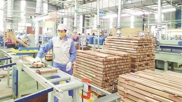
Plan on implementing Decision No. 327/QD-TTG dated March 10, 2022 of the Prime Minister approving the project on developing sustainable and effective wood processing industry in the period of 2021-2030 in Gia Lai province
Action plan on implementing strategy of sustainable agricultural and rural development in a period of 2022-2030 with a vision to 2050 in Hanoi city
Plan on implementing Decision No.923/QD-TTG dated August 2, 2022 of the Prime Minister approving science and technology program for new rural construction in a period of 2021-2025 in Vinh Long province
Plan on implementing strategy of sustainable agricultural and rural development in Bac Kan province in a period of 2021 - 2030 with a vision to 2050
Action plan on implementing livestock development strategy in a period of 2022-2030 with a vision to 2045 in Hanoi city
Implementation plan of Vietnam's forestry development strategy for a period of 2021-2030 with a vision to 2050 in Gia Lai province
National master plan in a period of 2021-2030, vision to 2050
Program on strengthening environmental protection, food safety and rural clean water supply in building new countryside in a period of 2021-2025
Digital transformation program on building new countryside, towards smart new countryside in a period of 2021 - 2025
Rural tourism development program on new rural construction in a period of 2021 - 2025
Project on development of trade, e-commerce systems and border trade in Binh Phuoc province in a period of 2021-2025, orientation to 2030
Plan on implementing Decision No. 327/QD-TTG dated March ...
Concretize viewpoints, objectives, tasks and solutions of the plan in accordance with practical conditions of the locality, associating ...Plan on implementing national environmental protection ...
Implementation plan of marine aquaculture development ...
Program on conservation and development of Vietnamese ...
Plan on improving quality of human resources to 2025 and ...

Efforts taken to turn culinary culture into national ...
The Vietnam Cuisine Culture Association (VCCA) is taking steps to implement a project to build and develop Vietnamese culinary culture ...Vietnamese cuisine making a name for itself with ...
Vietnam advance to next round of AFC U20 Women’s Asian Cup
Cultural tourism and traditional values promoted through ...
